Unknown's avatar

About caroltracycarr

Writer, Musician, Grandmother, Retired Attorney

Tale of Two Capitols

The Capitol buildings of North Dakota and South Dakota couldn’t be more different. One is caught in the 19th century, the state having just restored it to the 1890’s decor in celebration of its centennial. The other embraces wholeheartedly the more contemporary style of the Art Deco Period. The first is filled with tons of Vermont white marble to create a stunning staircase as its showpiece. The other glistens with columns and ceilings of stainless steel and glass chandeliers fashioned to appear like heads of wheat. Spawned as they are from the same seed, the Dakota territory, it’s amazing how dissimilar the two capitals are.

We stopped first in Pierre, the state capital of South Dakota. Minimal security to enter the building was a surprise, and we wandered freely. There had been considerable controversy about where to place the Capitol in the state when the decision to create a separate state of South Dakota was made, and that history was captured in several exhibits. Pierre won hands down due to its central location. Overall, the feeling in the Capitol was a reverence for its history which emanated from the wood paneling and wall coverings, the original roll-top desks, all of which have been restored to their 1890’s state of newness.

20130810-214225.jpg

20130810-214336.jpg

20130810-214408.jpg

The following morning, and 250 miles later, we drove up to a sleek skyscraper (well, the tallest building in Bismarck–18 stories) that looked completely unlike the majority of the Capitols we’ve seen that mimic the architecture of the Capitol in Washington DC. Security was non-existent here, so we perused completely alone the gallery of notable North Dakotans, and then explored the two legislative chambers with just a few other tourists. The modern decor is a beautiful example of contemporary architecture that draws from the importance of North Dakota’s farming and mining industries. I was most impressed that the Governor’s Office was the first door to the right of the front door.

20130810-214624.jpg

20130810-214650.jpg

20130810-214719.jpg

20130810-214858.jpg

Captured by the Indians

Little Bighorn National Monument is like a magnet for me–there is no way any vehicle I’m in–car, motorcycle or RV–can choose not to make the turn into these grounds that are as meaningful to our national history as Gettysburg. It is just as impossible for me to enter these fields without cheering the Native Americans for their defeat of the likes of Custer. The warriors and their tribes were duly punished for their victory with expulsion from their homeland, starvation, and death, and even today the tribes are struggling to regain their culture and self-sufficiency. I am glad they have at least one major victory to look back on.

This was my third time to Little Bighorn, so I wasn’t surprised this time by the hushed awe that flows from the ground, broken only by the rustle of grasses. It is so quiet that it is hard to imagine the hills filled with all the human sounds of the 7,000 Indians that were camped along the Little Bighorn, much less the cacophony of men in battle, the war cries of the Indians punctuated with rifle shots from both sides. The Battle of the Little Bighorn was tragic all around: 260 U.S. cavalrymen died, almost half of the U.S. troops engaged in the battle, and 60-100 Indians from five tribes.

Recognition of the bravery of the Native Americans defending their way of life has been slow in coming. When Roger first visited in 1994,some of the signage still described the Indians as savages and cited Custer as a fallen hero. Now, Custer’s command of the battle is held in question by many, and the history is told by NPS rangers in conjunction with Native American interpreters. Red markers like this one now mark the places where the Indian warriors fell in battle as the white markers do the fallen cavalrymen in the picture below.

20130809-200944.jpg

20130809-201013.jpg
Our next stop was like turning the page to the next chapter of the Native Americans story. St. Labre Mission, located about 60 miles east, is the site of a Catholic school that Roger supported while working at the Patent Office. It was started more than 125 years ago by the Church to address the miserable state of the Indian population that had returned after years of exile in Oklahoma. What they have achieved during those years is a remarkable campus from K-12 that prepares students for advanced education and meaningful participation in today’s economy while stressing and preserving their Native American cultures and the values of their faith. I toured the campus with a delightful 16 year old student, Devin, who hopes to go to Johns Hopkins and become a medical doctor. One of the primary goals of the mission is to develop self-sufficiency of their people. Devon is a fine example.

20130809-201120.jpg

20130809-201141.jpg

20130809-201200.jpg
Our last stop of the day was a drive through Sturgis, South Dakota, where the annual Sturgis motorcycle rally takes place. A sleepy village the rest of the year, tens of thousands of motorcyclists from all over the country converge there for a week in the summer to ride, eat, ride, shop at motorcycle tents, ride, drink beer, ride, sleep, and ride some more. The town takes it in stride, with some people renting out their front lawns for tenters for $25. We were there on the 4th day of the rally, and according to the evening news the bikers’ behavior was better than previous years, with only 171 DUI arrests, 147 drug arrests, 986 total citations and $11,900 cash seized. Those biker attorneys must stay pretty busy. I took my photos and we left quickly to the quieter streets of Wall, SD.

20130809-201449.jpg

20130809-201510.jpg

Yearning for Yellowstone

I have yearned to see Yellowstone National Park ever since we watched the “Christmas in Yellowstone” PBS documentary several years ago. Of course it was attractive to imagine seeing Yellowstone when crowds were minimal, but the best we could do was to visit in early August, one of the most popular months. Knowing we had every intention of returning someday to do the entire park, we opted for just an “appetizer” and chose to take the northernmost route through the park from west to east. Even though we did not enter the caldera where most of the exciting volcanic activity resides, including Old Faithful, there was still plenty to see.

20130808-204105.jpg
The Roosevelt Arch is at the north entrance of National Park in Gardiner, Montana. Constructed under the supervision of the U.S. Army at Fort Yellowstone, its cornerstone was laid down by President of the United States Theodore Roosevelt in 1903.

Our first stop was at the Horace Albright Visitor Center, located where Fort Yellowstone was first established. It is named for the first Superintendent of Yellowstone. Compared to some of the rough and primitive forts that were built across the west in the late 1800s, Fort Yellowstone was considered a very comfortable and prized assignment by the officers. The buildings are all made of salmon-colored block bricks, and they have weathered the years admirably. The original fort buildings are surrounded now with hotel and shopping facilities.

20130808-204306.jpg
It was in Yellowstone that we saw the most wildlife, notably the herds of buffalo that covered the roads from time to time. They appeared non-threatening, but numerous park service warnings forbade approaching deer, elk, and buffalo. There were also rattlesnake warnings throughout the park. As we stayed within the safety of our vehicle, the buffalo below was nearly close enough to touch. In the other picture, all the black specks extending far into the distance are buffalo. Considering the buffalo was nearly hunted into extinction, it’s a beautiful sight to see them now thriving.

20130808-205114.jpg

20130808-205522.jpg
Yellowstone is huge, impossible to take in in one visit. We knew this in advance, so as we left the park that afternoon we were already discussing plans to return. But in our abbreviated drive through the park we took in many beautiful mountain vistas, waterfalls, and lakes, and we followed the Yellowstone River through much of the park. All of it is incredibly beautiful.

20130808-205728.jpg

20130808-205747.jpg
Our trip from Yellowstone to Billings was breathtaking in a different way. Rte 212 is a collection of large hairpin turns that carry you up to 11,000 feet before taking you down to the valley again with as many turns as can be fit into the road in between. It’s a white knuckle ride with 6,000 feet drops just inches from your wheels when you’re in the outer lane. The picture below was taken holding my camera upside down out of my window. No, I wasn’t looking through the viewfinder.

20130808-210013.jpg

Montana State Capitol

There’s no way around it. You have to drive through many miles of open prairie, fields of wheat and hay, valleys full of grazing cattle peppered with some goats and antelopes, and cross many winding rivers when you’re crossing the state of Montana. So the first half of our second day out of Seattle was spent viewing all of those for several hundred miles. Our destination was Helena, the capital of Montana.

20130808-094459.jpg

We arrived around four in the afternoon, a bit uncertain whether we’d be able to see the entire capital in just an hour. We were successful. This was one of the rare state capitals were security was at a minimum. I think we surprised the security guard when we approached him. The tour was self-guided. Both House and Senate chambers were locked, so we had to view through the windows the murals that covered the walls.

The most impressive things in the Capitol were two bronze sculptures. The first was Jeannette Pickering Rankin, the first woman in the United States Congress, elected in Montana in 1916 and again in 1940. After being elected in 1916 she said, “I may be the first woman member of Congress but I won’t be the last.”

20130808-094645.jpg

A lifelong pacifist, she was one of fifty members of Congress who voted against entry into World War I in 1917, and the only member of Congress who voted against declaring war on Japan after the attack on Pearl Harbor in 1941. Both votes cost her her seat in the next election. The second bronze was of Maureen and Mike Mansfield. Mansfield served in Congress from 1943 to 1977, and afterwards served as ambassador to Japan for 11 years. Their statues stand in a place of honor on the second floor landing facing the rotunda. Beneath the statues is a quote from Mansfield: “IfI do not forget the people of Montana, the people of Montana will not forget me.”

20130808-094853.jpg

We left the Capitol at 5 o’clock along with many of the Legislative staff. We drove on to White Sulfur Springs, where I discovered we had forgotten to go grocery shopping. Dinner was interesting mishmash of the dregs of my tiny pantry and refrigerator: rice pasta, a half empty jar of spaghetti sauce I’d carried from Virginia, mixed together with some carrots and tomatoes. It’s amazing what you can find yourself eating when you’re camping. But anything tastes good when there’s ice cream at the end.

Heading Home

Well, we’re still three thousand miles and eight days away, but it feels like a different trip, now that we’re heading East instead of West or North and our own home is at the end of the road. We left Seattle around 9 on Monday, and by 10 the city was well behind us and we’d entered the mountainous terrain of Eastern Washington.

In the Northwest, it seems every major road follows a creek or river, and Route 2 hugs the Wenatchee River most of the way. It’s a beautiful river with all shades of personality: an overgrown brook gurgling over rocks turning to enthusiastic whitewater in a broadening river until it reaches the Columbia River just north of the town of Wenatchee.

20130806-194241.jpg

We ate lunch in Leavenworth, a town that, faced with extinction in the early 1900s when the mining and logging industries dried up and the railroad literally pulled up its tracks and left, completely reinvented itself to be a Bavarian village. The helpful woman at the Visitor Center was dressed like a character out of Heidi.

“There’s no German heritage here'” she said. “It’s all Walt Disney. A couple of creative developers saw the potential of building a tourist industry on the Bavarian nature of the surroundings and sold it to the city council. The business community bought into it as well and created what we have today.”
What they have is a thriving winter sports industry, as well as a busy fall Octoberfest and March and April bring tourists when the snow is melting. From what we observed, the summer season is well-attended too.

20130806-194718.jpg

20130806-195133.jpg

Shortly after heading out of Leavenworth, we met up with the bicyclists who had signed on for the 2013 RAW (Ride Across Washington) 15: “Pines to Vines.” They were well into their third day of the ride traveling 65 miles from Lake Chelan to Leavenworth which included 2,972 feet of climbing and 2,920 feet of descent. We agreed they were made of sturdier stuff than we, and we especially cheered on those at the rear, a good 30 miles or so behind the head of the pack. Fortunately they had a day of rest to look forward to at Leavenworth.

20130806-195950.jpg

Making time and miles was the agenda for the rest of the day, except for a brief detour through Spokane, a city we’ve skirted several times on convenient bypasses to avoid the town traffic, to see their Riverfront Park. The river was less than notable, moving sluggishly along the park, but the park sculpture was delightful: a huge wagon for the children, and an inspirational crowd of runners in metal.

20130806-201159.jpg

20130806-201433.jpg

We spent the night just across the state line at a campground in Post Falls, Idaho. Tomorrow, we’ll spend a brief time crossing the panhandle of Idaho and head on into Montana.

On Board With Boeing

I’m a Detroiter. Field trips in my youth included tours of the Ford plant in Dearborn, Michigan to watch the assembly lines in action spitting out new cars every ten minutes. The mechanics of large vehicle production are no mystery to me. But none of that prepared me for the awesome scale of the Boeing Everett Factory just north of Seattle, Washington.

20130806-112154.jpg
In a building that is the largest in the world by volume (its footprint covers 98.3 acres) dozens of airplanes are being built on an assembly line that moves along at 1.8 inches per minute. All of them are green, coated with a protective film that is easily removed when its time to paint them. Some are made from as many as 6 million parts.

The stats are staggering, and our guide, who had once been “on the line”, dropped them liberally throughout our one and a half hour tour as she took us on a brisk mile and a half walk through tunnels and around catwalks, and up and down freight elevators painted to look like the interior of a cargo plane.

Fore example:

The 747 has logged more than 42 billion nautical miles, equivalent to 101,500 trips from Earth to the moon and back.

The 787 Dreamliner has approximately 70 miles of wiring.

Each of the hangar doors (there are six of them) is more than half the size of a U.S. football field.

It takes 21 days from start to finish to complete an airplane. Several days of that are required to cure the final paint job, the majority of which is done by hand.

20130806-112333.jpg

20130806-112351.jpg
She saved the best for last, the assembly line for the new Dreamliner. Scheduled to be launched in September, this plane of the future provides an environment that mimics your destination by subtle manipulations of the lighting so that jet lag will be minimized. Some seats are constructed like mini-cubicles for maximum privacy and comfort, and it’s designed to use 20% less fuel and be substantially quieter because of the chevron design on the covering of the engine. The neatest innovation is the window shading, accomplished with the push of a button that will lighten or darken the window automatically. The windows are larger too, which make the interior feel brighter and more open. No puddle jumper, this plane is an ocean hopper, designed to get you from Hong Kong to New York with maximum comfort in minimal time.

While I highly recommend the tour, the Visitor Center is worth stopping to see as well. it has several good exhibits on the walls and two great shops with a huge collection of airplane models to choose from almost as awesome as the factory itself.

Challenging the Hood River Bridge

20130802-100154.jpg

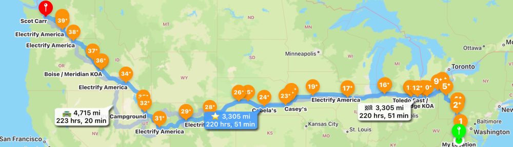
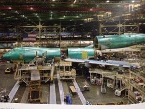
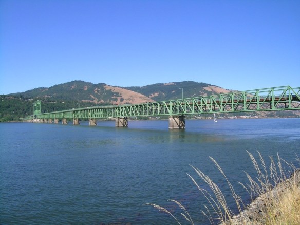
As we crossed over the Hood River Bridge into Washington, it reminded me of the first time I did it in 1996 on the backseat of a motorcycle. I captured that event in the following short essay.

Finding Religion on the Road

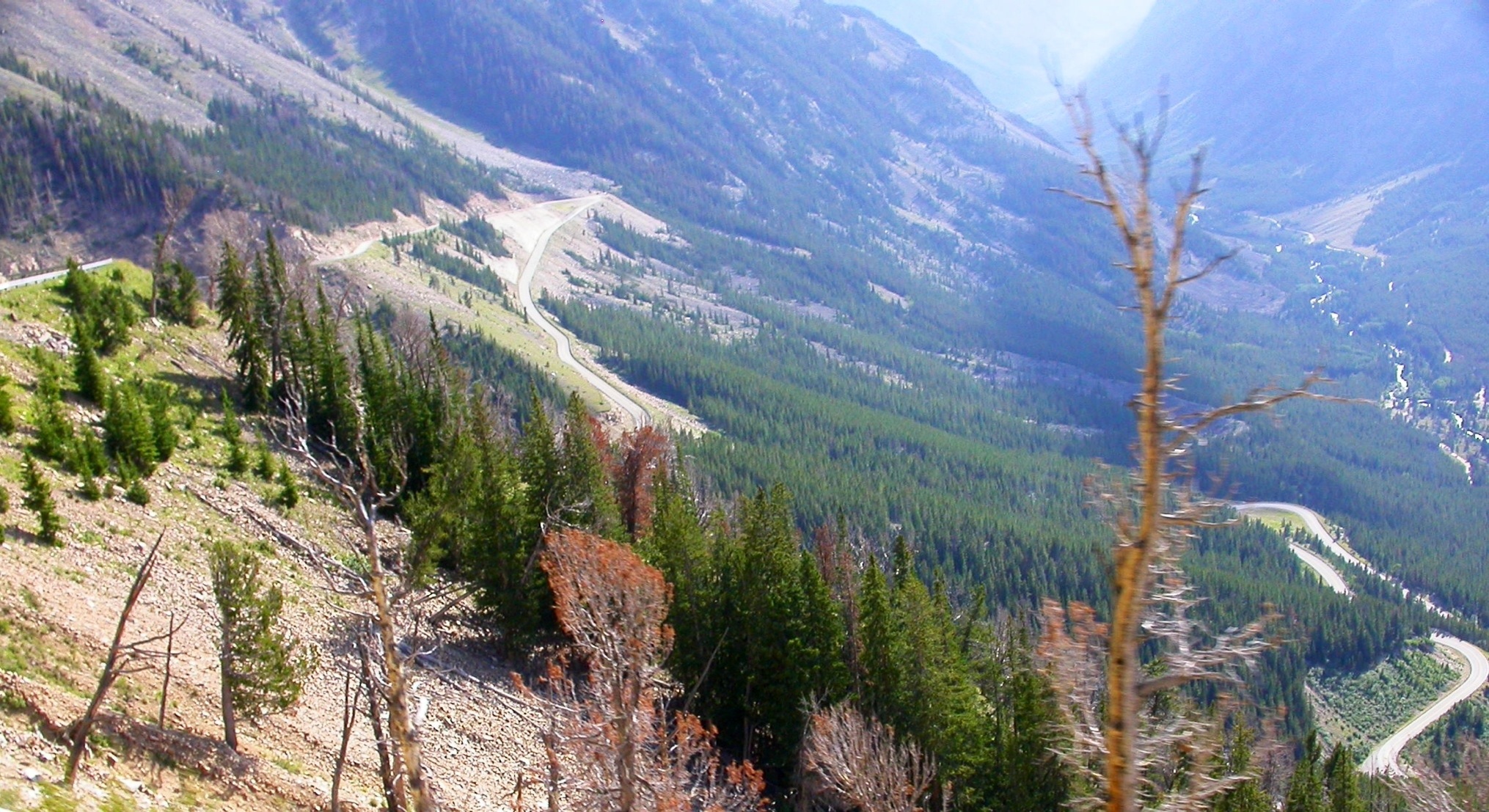
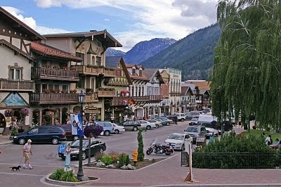
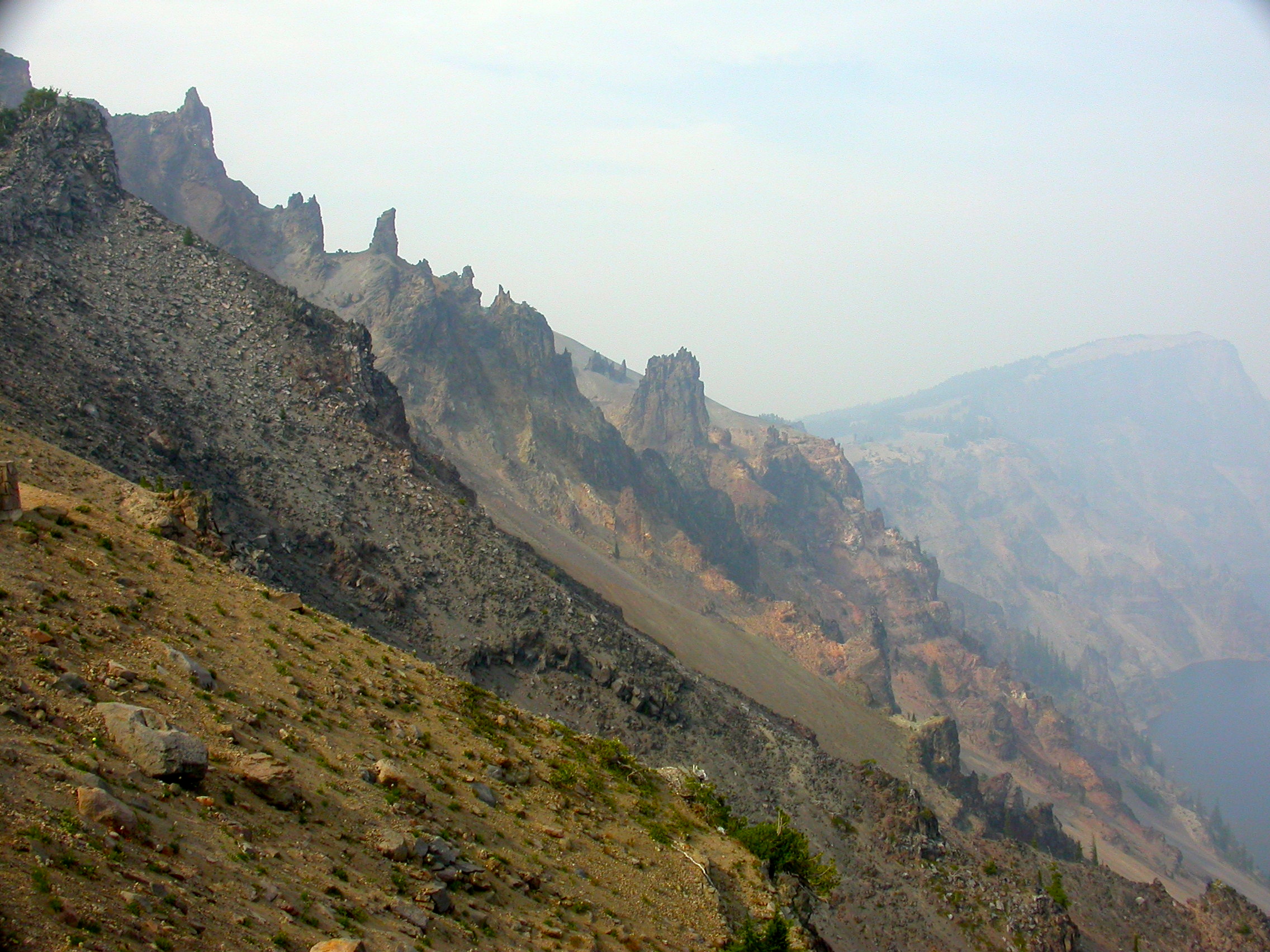
It was a brilliant Sunday morning in August, and we were heading north to Seattle on Route 141, looking forward to a stop at Mt. St. Helen’s along the way. We’d camped out along the Columbia River the night before at The Dalles and had just breakfasted at a motorcyclist’s diner in Hood River before crossing the bridge over the Columbia River Gorge into Washington. The strong breeze we’d felt wandering up and down State Street in Hood River looking for a restaurant should have given me some inkling of what we were about to face, as well as the myriad number of wind-surfing shops. But I was naively comfortable with the many bridges I’d conquered in my short motorcycling career and no longer feared anything.

“You know, gusts can reach up to 30 mph in the Gorge,” my husband mentioned casually as we donned our helmets in the diner parking lot.

“Really?” Just like I’d learned how to lean into the curve, I’d learned to keep my body straight with his, so I figured I’d have any challenges to our upright position nailed if I just stayed in line with him.

“Not so bad by itself,” he continued, “but it’s a narrow, old bridge and the road is an open metal grate. It’s a challenge because the grooves of the grating and the treads of the tires never seem to get in line together, and I’ve got to fight to keep the bike going straight. We’ll have to take it slow, but we can’t go too slow either, or it’s even harder to control. Just sit as still as you can.” That was easy; by then I was frozen, my hard-won courage having deserted me.

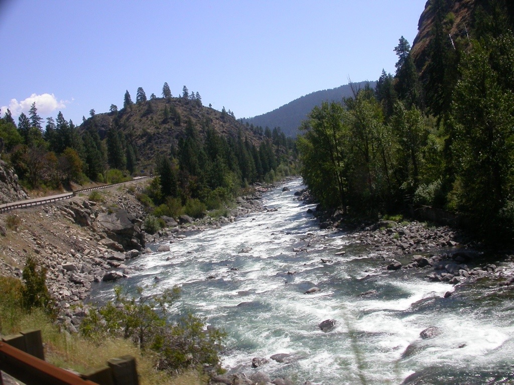
The bridge itself looked innocuous. It was flat and relatively short compared to some of the monster structures we’d already tackled together. Parked at the traffic light before we began our crossing, the sound of the churning river ahead and the blustery wind were like an awesome, dissonant symphony. As we took off, a stunning scene unfolded before us as we entered the panorama of the Columbia River Gorge. I forgot all my intentions to keep my eyes shut at the spectacular sight of the Columbia River on a Sunday morning filled with hundreds of multi-colored windsurfers collected there to grab the best wind of the day. Brilliant-hued sails peppered the water, all heading swiftly in the same direction like a flock of low-flying, migrating geese. It was a spectacular regatta of every color in the rainbow, as if the river had come alive with jumping tropical fish. For a few seconds I forgot any angst over our unstable road beneath.

Then I heard a loud hiss through the intercom, and I knew it was my husband sucking in his breath, never a good sign. I sensed the wheels’ attempts to fishtail on the grating as their treads sought an elusive, comfortable groove, and I felt his muscles tighten as he controlled the hundreds of pounds of metal between our legs. By this time I was holding onto him like a bloodsucker.

“It’s better if you don’t look through the grates,” had been his last words of advice while we sat at the light, and of course the moment I remembered that, my eyes flew downward. Through the holes in the grating, the sails of the windsurfers looked like colorful specs on the roiling water below. Reality sank in. We were less than a hundred feet above a raging river that could carry us out to sea in minutes or, at its whimsy, dash us into the huge rocks on the shore, and all we had to keep us from tumbling into it was a relatively thin sheet of metal mesh that was doing its best to confuse the tires beneath us.

This called for reinforcements. It was Sunday morning after all, so I began to pray, reciting every prayer I’d ever learned as a child, some several times over before we reached the other side. It gave me an unusual sense of comfort, and I wondered why I hadn’t tried this before. With my newfound source of courage, I even grabbed another glance through the grating.

Sometimes life seems to smack you in the face with a brick saying this is a once-in-a-lifetime experience—relish it! I did. And as we wandered up the north side of the Columbia River after our treacherous crossing, passing the hundreds of cars parked along the edge of the road carrying the gear of all the windsurfers, I realized that I’d experienced something that, for me at least, was nearly as reckless as the brave wind-borne souls taking their chances in the river below. And survived. Life doesn’t get better than that.

Mt. St. Helens

Trees spread over mountainsides like toothpicks spilled from a box. Half-blasted mountain top, still raw from explosive force. A mountaintop viewpoint with Spirit Lake on one side, so covered with fallen trees you can’t see the water, and Mt. St. Helens standing battered but not completely broken on the opposite side. These are my memories from 17 years ago when I first saw Mt. St. Helens.

Yesterday, 33 years after the blast, the land is less raw than when I saw it first. The toothpick piles of trees are still there, but the land surrounding it is now covered with green. Not many trees, but plenty of shrubs and ground cover. Spirit Lake has nearly doubled in size, and the water is now visible, with only the northern end of the lake covered with wood. As it is a National Monument, there has been no clearing of the fallen timber, and some of it looks ready to fall on the road. The road itself is in terrible shape, with plenty of head-to-ceiling bumps to keep you awake. It was easy to say “I’ll never do this again” until you reach the top viewpoint. Then you realize you’re seeing something unique and special.

Trees like toothpicks

Trees like toothpicks

Spirit Lake

Spirit Lake

To the top of the viewpoint of Mt. St. Helens

To the top of the viewpoint of Mt. St. Helens


Crater Full of Smoke

Fires are to be expected out West, where lighting and wind set off enough to keep firefighters busy all summer. Add the human factor, and it quickly becomes unmanageable. So it wasn’t a big surprise, but it was a huge disappointment, that the day we’d scheduled our trip to Crater Lake was also a day when forest fires had broken out west of the park several days before. Even though they were now contained, the remainder of their smoke was hovering over the water of Crater Lake, captured by the caldera that made it very difficult for it to dissipate.

I’d been to Crater Lake about fifty years ago when I was a teenager, and I saw it then in my own self-induced haze of dramamine druggedness, so I was looking forward very much to a clear view of the deep blue water contrasting the crisp greenness of the surrounding forests. Every photo you see of Crater Lake shouts of this reality. Instead, we were greeted with a mystical view of ghosts of trees on Wizard Island that rose in the middle of the crater, an after-thought eruption, now a volcano within a volcano. Shadowy speedboats zipped through the water like water-striders moving in and out of the low-hanging clouds of smoke. It was a unique and rather satisfying experience.

DSCN7592DSCN7616

DSCN7620


I’ll have to return one more time to see the Crater Lake of my fantasies. There was a saving grace to the day, however. Earlier in the day, we had stopped at Burnley Falls and happened to catch it at one of the rare times of day when the sun was on the waterfalls. They are some of the loveliest falls I’ve ever seen, tumbling at several places along a tall cliff sprinkled with greenery in a haphazard manner. It was one of those sights we weren’t even aware of and couldn’t have planned for, but an encouraging nudge from a general store clerk spurred us to explore. It was a treasure of a find.

Burnley Falls

Burnley Falls

Lassen (or Another Boondoggle Day)

Well, more a semi-boondoggle day. It started with us getting lost just north of San Francisco. A GPS has an unusual mindset sometimes, and that morning ours firmly believed that side streets with speed bumps were a more direct route north than I-80. Our destination was Lassen Volcanic National Park. But once we successfully found I-80 we failed to take a right turn where we needed to and were on the wrong road, then discovered our error, retraced our steps only to learn that the right road was closed 47 miles ahead (just a few miles before the park), so the wrong road we’d taken was actually the right road. All this added a good hour to our trip.

We finally arrived at Lassen Volcanic around 4pm, and it turned out to be a lovely time to drive the tour road through the park. The park was fairly empty, and the light was good for photographing the peak and the surrounding lakes. Lassen Volcanic is still an active volcano, as it’s been less than 100 years since it erupted. The road, another masterwork of switchbacks to rival Rocky Mountain, climbs through the park to reach 8,512 feet and then slowly descends to about 6,000 feet at Lake Manzanita where we camped. We especially enjoyed a stop at Emerald Lake, a glacial lake that was isolated when the glacier receded. Algae at the bottom of the lake give it a deep greenish-blue color. The lake was stocked with rainbow trout many years ago which they are trying to remove, as they feed on the tadpoles of a rare native species of frog.

20130730-153310.jpg

20130730-153346.jpg

20130730-171847.jpg

20130730-172002.jpg

You can’t travel anywhere in the West without being faced with man’s intervention with nature in the form of dammed rivers, mining operations, land-clearing for crops or asphalt parking lots for large shopping centers, or air filled with smoke from man-made forest fires or factories. In some cases, it is arguably progress. But when you visit the national and state parks and see their pleas to save the bears, the trees, the frogs, to not interfere with the wild animals or the land that holds precious fossils, or to protect the rivers and their inhabitants, you have to wonder at what we’ve already done to this Earth and what the real long term effects will be. It’s chilling to look at a place like Yosemite and realize that there were once powerful men who only saw it as a rich resource of raw materials for industry or commerce. Fortunately it has been preserved for us by the federal government, but how much else of our incredible country is at risk? How much can we afford to sacrifice to progress?